
Built for anyone who has ever needed to understand what is really happening in the world
Overview
Project EDITH is a map of the things that shape world events and sit underneath every headline. Whether you work in defense, finance, journalism, policy, or you just want to understand the world better, it puts the whole picture in front of you, so you can understand events as they unfold instead of after someone else has explained them.
The Infrastructure Behind Every Headline
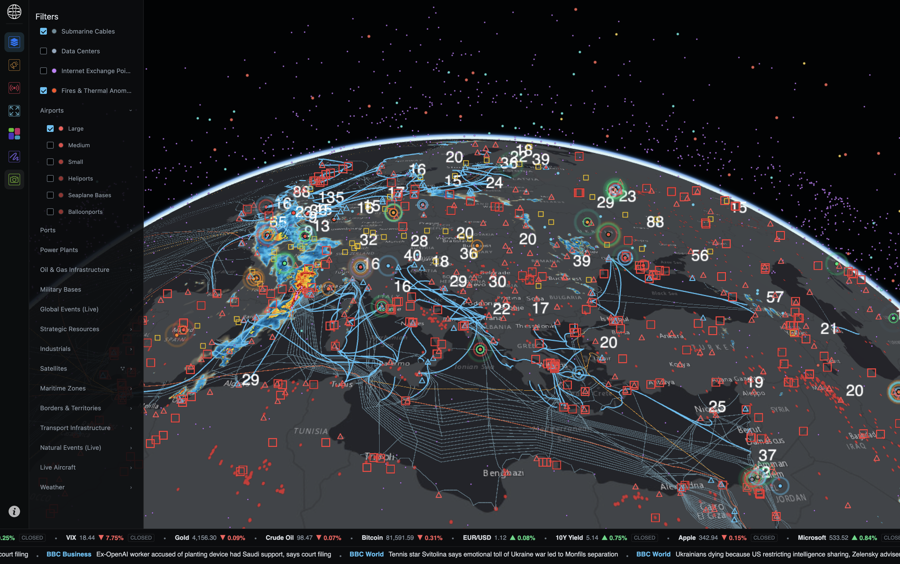
Power plants, pipelines, ports, airports, submarine cables, data centers, military bases, critical minerals and the satellites passing overhead, among others, each on its own layer that you can turn on, combine and filter.
You can look at any region with as many layers as you need, and click on anything to see what it is and where the information comes from.
What’s Happening and Where It’s Happening
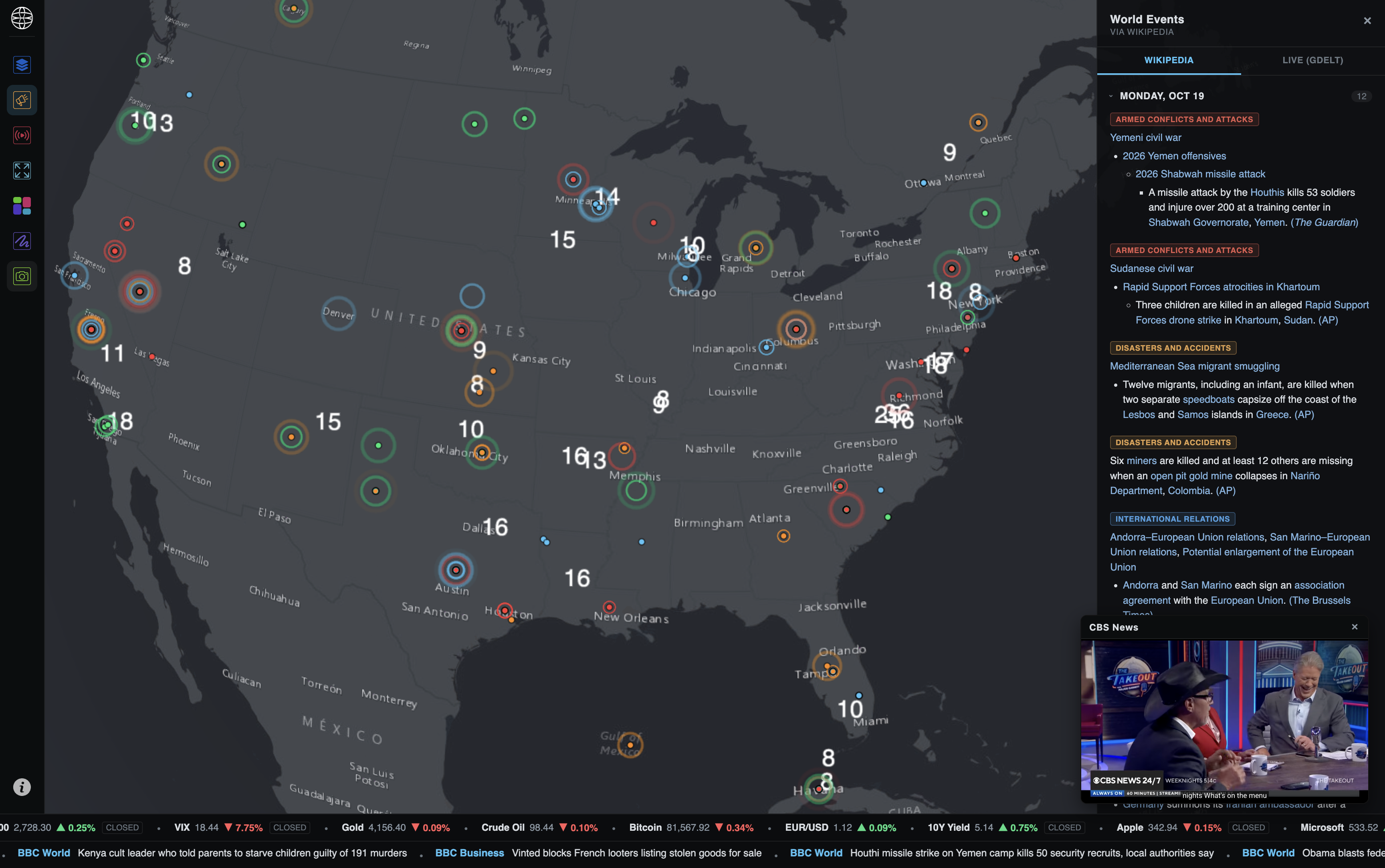
Live news and events from around the world appear on the map as they happen, placed where they’re actually taking place instead of buried in a feed.
Every event shows up in context, next to the infrastructure, borders, and routes around it, so you can tell what it might affect instead of just knowing that it happened.
Focus on the Areas That Matter to You
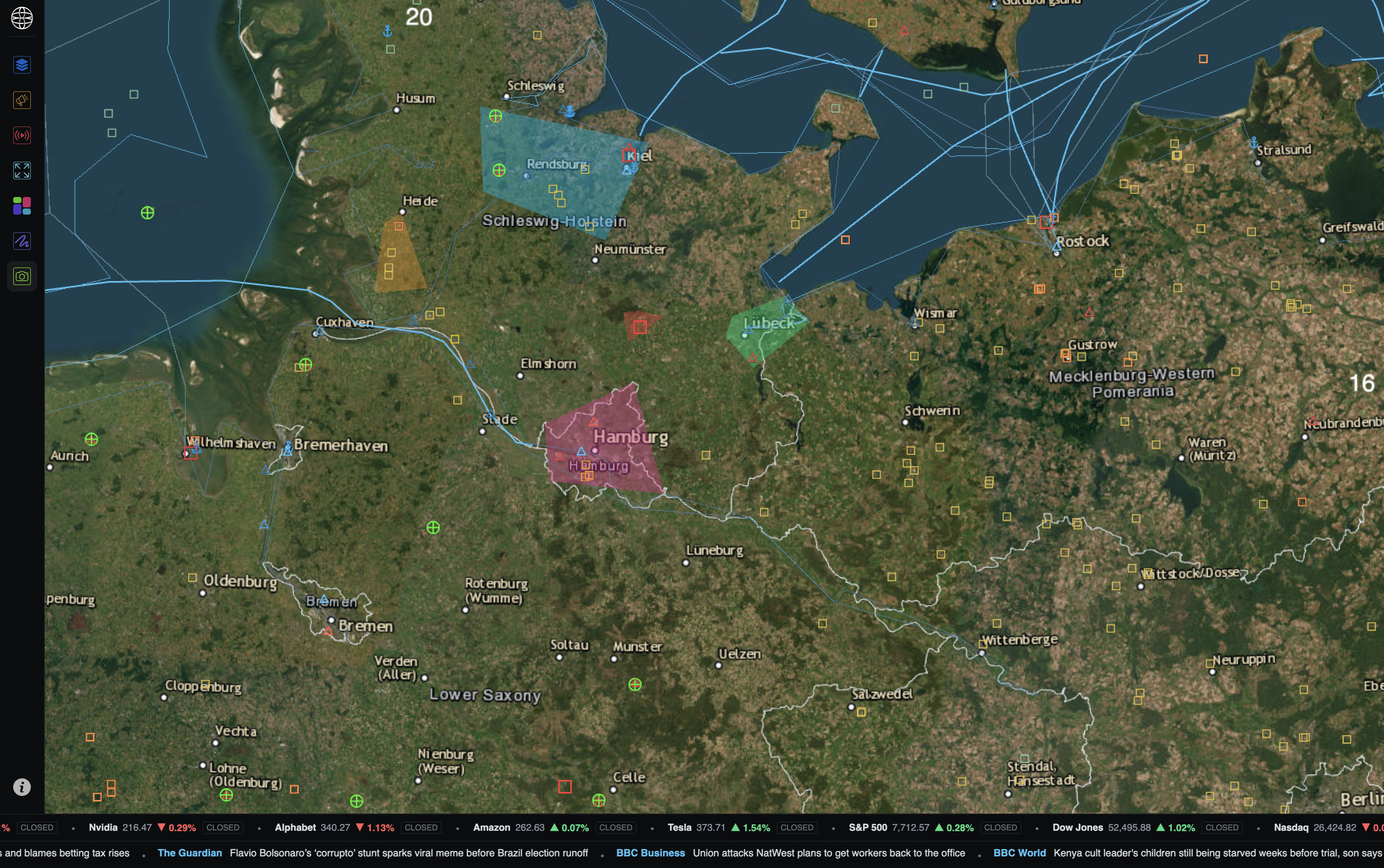
Mark out any region on the map, whether it’s a strait, a border area, or a city, and see everything that falls inside it across every layer at once.
Turn the map into a research tool. Instead of relying on someone else’s analysis, you can define the area you care about, follow what’s happening inside it, and draw your own conclusions.
Made for How You Work
EDITH has details that make it easier to work with every day, and to share what you find with others.
-
Themes
Switch between visual themes to suit how you work, or what you're presenting.
-
Any Angle
Tilt and rotate the globe freely, from a view of the whole planet down to a single port.
-
Satellite Orbits
Click on any satellite to see its full orbit traced around the Earth.
-
Live Aircraft
Follow flights around the world as they move, in real time.
-
Snapshots
Capture your current view to share with colleagues or drop straight into a report.
Built on open data. Runs wherever you do.
For early access or questions, you can reach me here.